.
QGIS Browser
The QGIS Browser is a panel in QGIS that lets you easily navigate in your filesystem and manage geodata. You can have access to common vector files (e.g., ESRI shapefiles or MapInfo files), databases (e.g., PostGIS, Oracle, SpatiaLite or MS SQL Spatial) and WMS/WFS connections. You can also view your GRASS data (to get the data into QGIS, see Integratie van GRASS GIS).
Figure browser 1:
QGIS browser as a stand alone application 
Use the QGIS Browser to preview your data. The drag-and-drop function makes it easy to get your data into the map view and the map legend.
- Activate the QGIS Browser: Right-click on the toolbar and check
 Browser or select it from
Settings ‣ Panels.
Browser or select it from
Settings ‣ Panels. - Drag the panel into the legend window and release it.
- Click on the Browser tab.
- Browse in your filesystem and choose the shapefile folder from qgis_sample_data directory.
- Press the Shift key and select the airports.shp and alaska.shp files.
- Press the left mouse button, then drag and drop the files into the map canvas.
- Right-click on a layer and choose Set project CRS from layer. For more information see Werken met projecties.
- Click on
 Zoom Full to make the layers
visible.
Zoom Full to make the layers
visible.
There is a second browser available under Settings ‣ Panels. This is handy when you need to move files or layers between locations.
- Activate a second QGIS Browser: Right-click on the toolbar and check
Browser (2), or select it from
Settings ‣ Panels.
- Drag the panel into the legend window.
- Navigate to the Browser (2) tab and browse for a shapefile in your file system.
- Select a file with the left mouse button. Now you can use the
 Add Selected Layers icon to add it into the current project.
QGIS automatically looks for the coordinate reference system (CRS) and zooms to the layer extent if you work in a blank QGIS project. If there are already files in your project, the file will just be added, and in the case that it has the same extent and CRS, it will be visualized. If the file has another CRS and layer extent, you must first right-click on the layer and choose Set Project CRS from Layer. Then choose Zoom to Layer Extent.
The  Filter files function works on a directory level.
Browse to the folder where you want to filter files and enter a search word
or wildcard. The Browser will show only matching filenames – other data
won’t be displayed.
Filter files function works on a directory level.
Browse to the folder where you want to filter files and enter a search word
or wildcard. The Browser will show only matching filenames – other data
won’t be displayed.
It’s also possible to run the QGIS Browser as a stand-alone application.
Opstarten van de QGIS browser
- Typ “qbrowser” in op de opdrachtregel.
 Start the QGIS Browser using the Start menu or desktop shortcut.
 The QGIS Browser is available from your Applications folder.
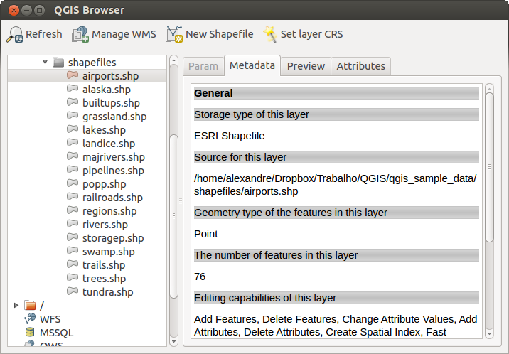
In figure_browser_standalone_metadata, you can see the enhanced functionality of the stand-alone QGIS Browser. The Param tab provides the details of your connection-based datasets, like PostGIS or MSSQL Spatial. The Metadata tab contains general information about the file (see Tabblad Metadata). With the Preview tab, you can have a look at your files without importing them into your QGIS project. It’s also possible to preview the attributes of your files in the Attributes tab.