Compemento Caminho Mais Curto
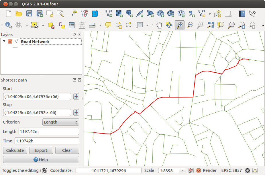
The Road Graph Plugin is a C++ plugin for QGIS, that calculates the shortest path between two points on any polyline layer and plots this path over the road network.
Figure Road Graph 1:
Main features:
calcular o caminho, seu comprimento e a duração das viagens
otimizar pelo comprimento ou pelo tempo de viagem
exportar caminho para uma camada vetorial
destaque direções de estradas (isso é lento e utilizado principalmente para fins de depuração e para o teste de configurações)
As a roads layer you can use any polyline vector layer in any QGIS supported format. Two lines with a common point are considered connected. Please note, it is required to use layer CRS as project CRS while editing roads layer. This is due to the fact that recalculation of the coordinates between different CRS introduce some errors that can result in discontinuities, even when ‘snapping’ is used.
Na tabela de atributos da camada os campos que se seguem podem ser usados:
velocidade no trecho de estrada — campo numérico;
- direction — any type, that can be casted to string. Forward and reverse directions are correspond to the one-way road, both directions — two-way road
If some fields don’t have any value or do not exist — default values are used. You can change defaults and some plugin settings in plugin settings dialog.
Using the plugin
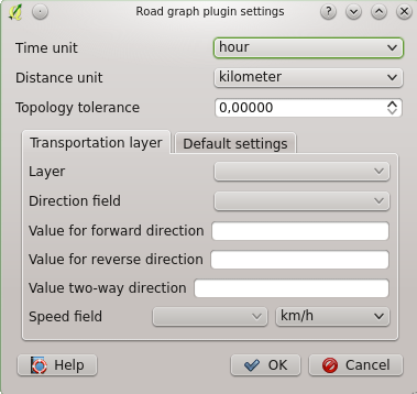
After plugin activation you will see an additional panel on the left side of the main QGIS window. Now make some definitions to the Road graph plugin settings dialog in the menu Vector ‣ Road Graph (see figure_road_graph_2).
Figure Road Graph 2:
After setting the Time unit, Distance unit and Topology tolerance you can choose the vector layer in the Transportation layer tab. Here you can also choose the Direction field and Speed field. In the Default settings tab you can set the Direction for the calculation.
Finally in the Shortest Path panel select a Start and a Stop point in the road network layer and click on [Calculate].


